Short Version: The run to or, like today, from work takes about 80 minutes and, even at my slow pace, this covers a lot of ground with a lot to see. I also have a history of documenting this sort of map-able run (see the London Tube Project or the Outer Orbital Loop for examples). This is a long post but mostly a photo essay and it lays the groundwork for shorter ones to build on it.

Fucking Long Version:
The now-twice-weekly (and brief) visit to the labs finished for the day, I headed home on the canals (9.6 miles). The weather will shift over the weekend so I took advantage of the glorious sunshine to photo-document the bridges I am getting to know on this commute route. This screenshot of the map of “Canal Furniture” is linked to the actual map that will expand over time; currently, it only has sections for graffiti and bridges on the canal path I ran today (and some other times) but I’ll add to those as I explore the network.

Today the start was at University Station:

Under Pritchatt’s Road:

And, Somerset Road:

The Birmingham Swifts (I miss those guys…now that evening daylight has returned AMD maybe when the plague is over…) make occasional loops into the Vale using this footbridge as the southernmost extent of the Thursday runs:

The Edgbaston Tunnel is next with its noisy footbridge running the length:


St James Road followed on after that:

Islington Row Middleway has an exit by Five Ways Station:

Bath Row has a notoriously slick surface on the wide path under it:

You will have noticed some graffiti along the way. These next ones (here and here) turned up a couple weeks ago and I can’t decide if they are intentionally racist and if so then is it ironically:


The slot just beyond the Granville Street Bridge is a frequent entrance/exit for the Swifts Thursday runs:

The Mailbox is a snooty shopping area, now closed for the COVID-19 duration. The steel footbridge to it shown here has BBC West Midlands in the background:

The canal turns to the left here. There are some atmospheric and hugely overpriced pubs on the left (two cyclists are taking advantage of the otherwise COVID-19-abandoned benches at one of them by the bridge to the wharf where the first couple of Zomboat episodes took place).

Just past that, the canal tunnels under a house on Broad Street. The bridge is known as the Black Sabbath Bridge:

The tunnel (above) and the signage for the BSB on the other side (below). There’s a Brum Walk of Fame up there on Broad Street and a life size cut out of Ozzy and the boys on a bench.

In rapid succession, a footbridge to the Conference Centre:

Another, older one next to the Brewmaster’s House:

And, two at the Old Junction straddling the Malthouse heading to Arena Birmingham:

They’ve done a good job tarting the place up in this part of town but keeping — or, in some cases, remaining true to — original features. Here is an old iron bridge between Brindley Place and the Arena, and it is tied to another crossing a branch of the canals looking back toward the aquarium:


Turning back to the path, the next bridge is where I cross over at LegoLand:

Sheepcote Street is next, and just past its arch on this side you find the Distillery

On the other side, the footbridge over the entrance to King Edward’s Wharf is modern but sympathetic:

St Vincent Street, next, can act as an exit to Ladywood or the Library:

Some old wharf entrances lead nowhere. This one has been filled in and there is a car park under it. The bridge remains.

Other wharfs still exist but the factories and loading docks have long since gone:

The little wharf bridge (above) can be seen in the shot of Monument Road Bridge (below). The road is now called Ladywood Middleway and is a massive — if ugly — boulevard. The Welcome to Brum graffito (from the top of this article) is under this bridge.


The daffodil bridge at the lower end of Rotton Park has featured in the commuter runs, previously:

A few dozen metres farther along, a bridge brackets the Rotton Park wastelands:

Almost directly across from this, I cross a canal loop entrance I ran back when we lived in Weoley Castle (and will re-run to add the bridges, there, sometime):

Just beyond that is the bridge where the Swifts Thursday runs that do this part of the canal crossover for the return trip:

A massive railway abutment sits in the midst of the canal. This must have been a magnificent bridge, once:

Another renamed street crosses the canal using the 1825 Lee Bridge:


The Winson Green Bridge looks suited for heavy freight:

The ERK! tag is all along the canals (down below the University, even, where this photo dump started, if you remember back that far):

The Hospital Loop completes at this bridge by what I assume to be a tollmaster’s house:

That;s also the one you see the cyclists passing over in my direction of travel. Beyond, the iron one ahead is called Turnover Bridge No. 3.

It dates to 1848 (one of the newer structures).

I had to look up ‘turnover bridge.’ Essentially, these exist where the towpath switches (or, historically, switched) sides. The ramp on either side points the same direction so you don’t have to remove the towline from either the horse or the barge.

I cross an old service channel where, frequently, I encounter old junkies and drunks sleeping or partying many mornings:

Back on the other side, two entrances to the Cape Arm still exist:

A railway bridge that, among other routes, conveys between Birmingham and Wolverhampton sits up ahead. Just before you get to that, there is a lot of interesting graffiti. I previously posted the Pulp Fiction and Dr Fresh images and will add to these on this stretch in due course.

The fat unicorn and wizard squid of the What’s Kraken? Bridge (for lack of another name) also made it onto the current version of the graffiti map:

Seen looking back toward Brum, the factory on your left also has a long stretch of cartoon graffiti to document.

Art is even in the most bleakly industrial bits of the canals. The Rabone Bridge has a ceramic plaque out in the middle of it:


As well as some more transient installations:

The canal splits — or rejoins depending on your direction of travel — at Smthwick Junction where two turnover bridges allow you to choose either side of either the higher canal or the lower one. I continue down the lower one, today:


My path is off to the left:

Just off to the right, though, is another factory access bridge without a factory to access:

Bridge Street North crosses both branches of the canal. I’m calling this one Bridge Street North Bridge (South):

One of the more impressive bridges is this aqueduct, the Engine Arm Aqueduct.

A beauty:

The canal approaching Brasshouse Lane is deceptively rural (on either side of the bridge, up top, it is decidedly urban):

The canal remains flat as the landscape climbs around you. This tunnel is the longest subterranean stretch of the day:

It emerges at the Grade 1 listed Galton Bridge:

Obscuring the view of the magnificent structure is a still loverly railway bridge at Smethwick Galton Bridge Station:

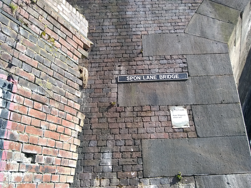
The Spon Lane Bridge would also be stunning save for the plumbing hanging just under:


The next couple of freight bridges have gone derelict and are covered with vegetation. The first one is also decorated with a sunburst mosaic on one side and a test pattern mosaic on t’other:


The next one dead-ends into a wall on the right and the rail line on the left:

It actually has a name (Hartley Bridge) marked on an abutment across the canal:

The next one is overshadowed by the M5 motorway flyover and the google map view shows it to be another aqueduct:

Dreadful:

The upper and lower branches come back together as we approach Oldbury and West Bromwich. I’ll take the bridge over and continue down the left side:

But, could easily run through the industrial sites off to the right (when the pubs reopen, surely).

The old iron bridge next up is lovely and no longer seems to serve any other purpose than that:

The Bromford Lane Bridge was unusually busy for this 5th full day of Lockdown:

There are muddy, disused towpaths on the other side so for completeness I include this footbridge next to a meadow:

And, its sister just a few metres further along (the map shows National Cycle Route 81 on that side but you’ll have happier riding where I am standing):

And, now it is time to leave the canal and do the last mile or so overland to the house. The Pudding Creek Bridge has proven thus far useless with the muddy footpaths on that side, but I hope to explore in dry weather:

And, the Albion Bridge is the end of this trip. Phew. If you’ve made it this far, you truly are grasping at entertainment straws.