The car park to St Mary’s is long and tree lined and the tree tops sort of frame the church spire, and intersectional Tiangulation Point (#19616). Looks like good use is made of the car park at least one day per year:
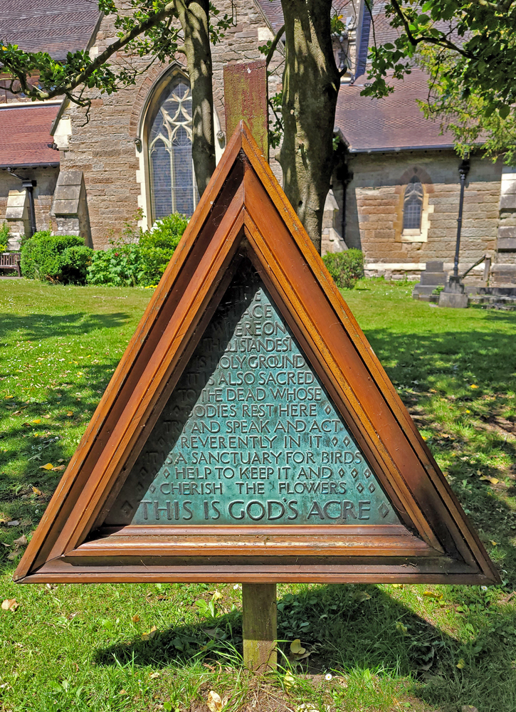
The grounds are lovely. “The space whereon thou standest is Holy Ground. It is also sacred to the dead whose bodies rest here. Try and speak and act reverently in it. It is a sanctuary for birds. Help to keep it and cherish the flowers. This is God’s Acre.”
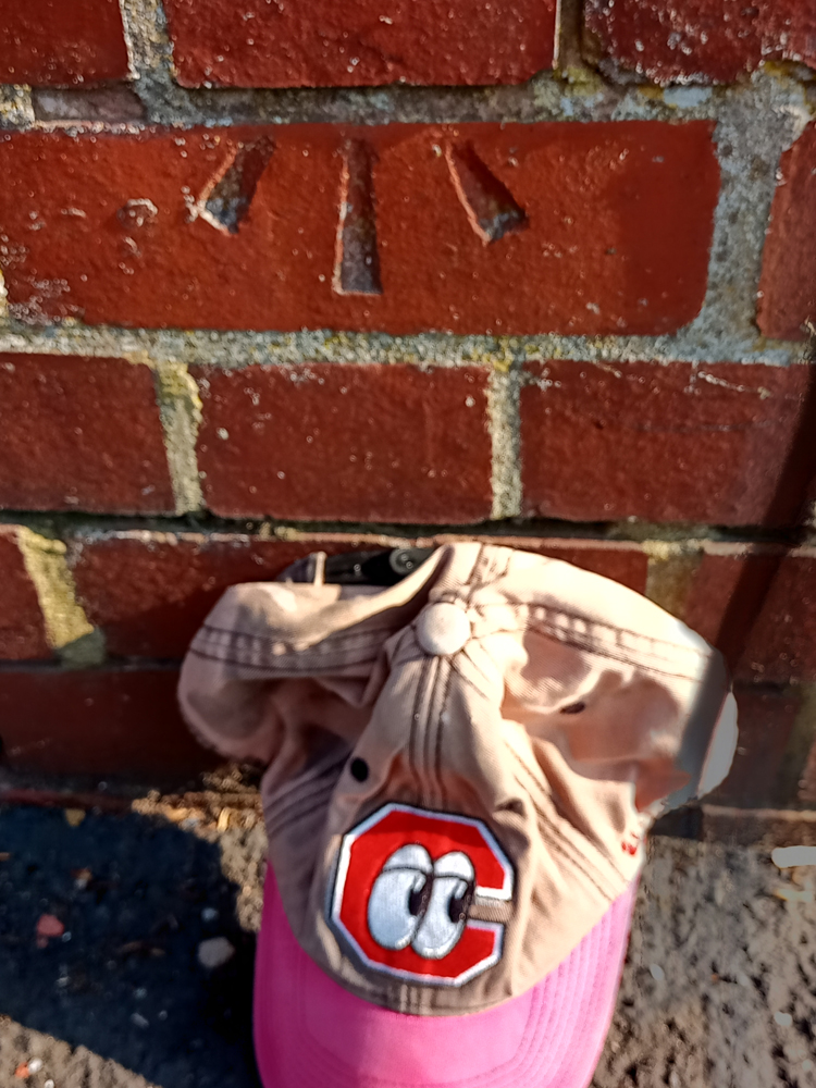
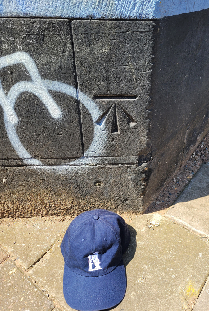
The Cut Mark is on the NW buttress. Something primordial in me wants to giggle at Cut Mark on Butt, but that would not be solemn.
After work run in the vicinity was going pretty well then I tried a section of the Ridgeacre Canal that is usually more passable (‘easily navigable’ vs ‘fucking overgrown’) and, since I was reduced to walking through the rice paddies/nettle grove I checked for nearby OS marks. Just ahead at the next bridge the legs still existed but the bench had suffered some repointing.
Continuing down the waters, Black Lake Bridge bore the stamp of the masonry supplier (guessing between 1870 and 1900 from this blog on the topic) on the capstones and, closer to the centre, the benchmark (faint, but still visible partly due to the vandalisation…bless ’em).
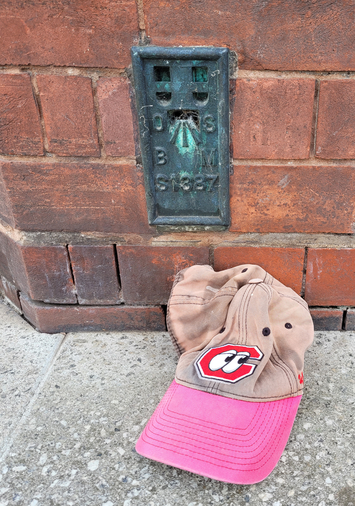
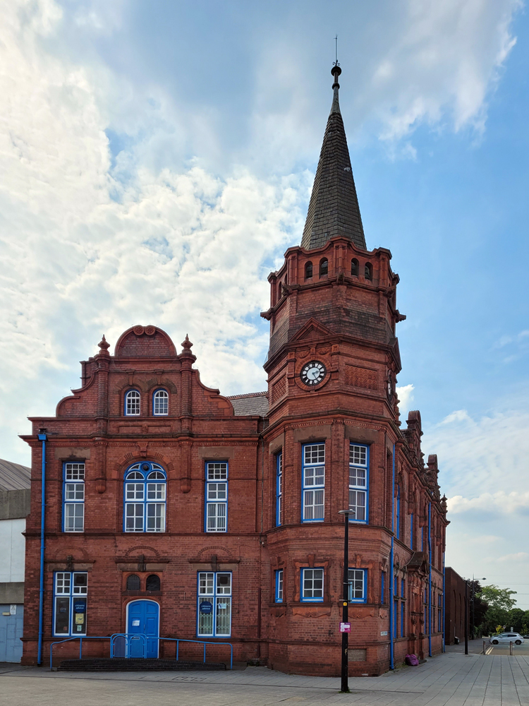
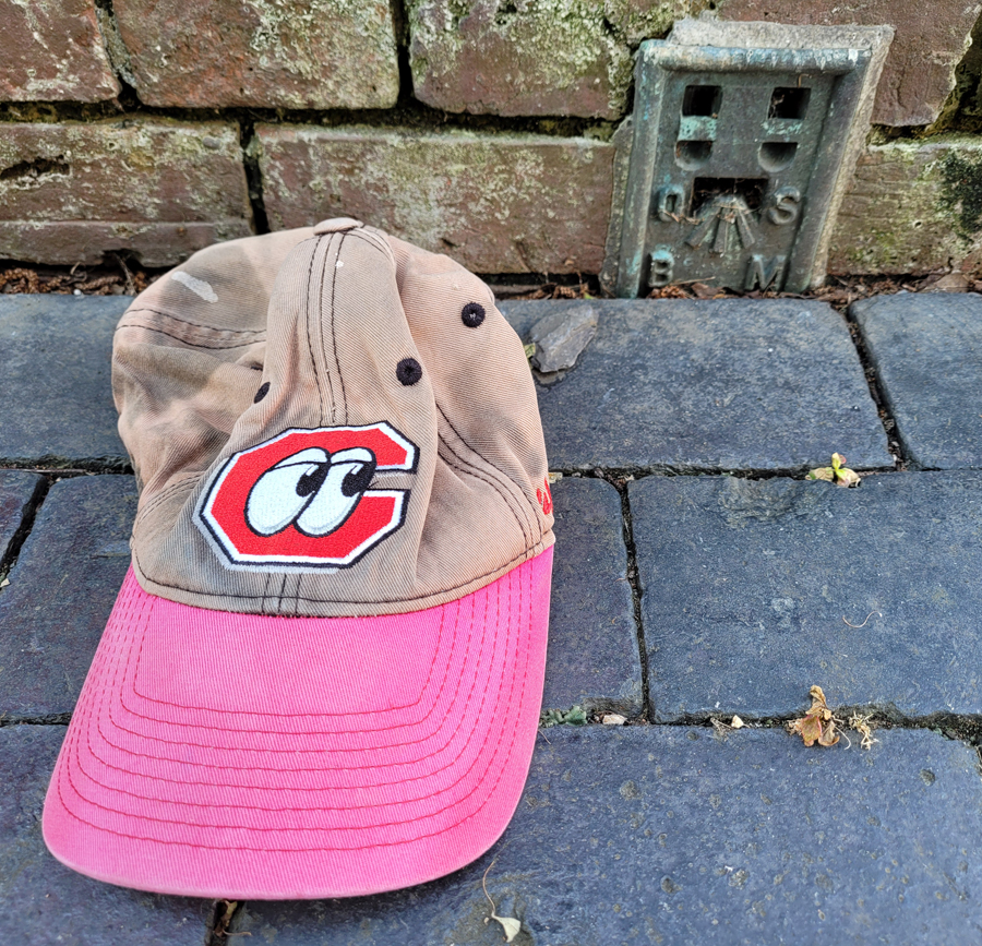
It was another unusually warm day and I waited until peak heat to get out for a run. I had 3 targets and achieved them all. The first was the old municipal building in Oldbury (below) with Flush Bracket #S1387, above.
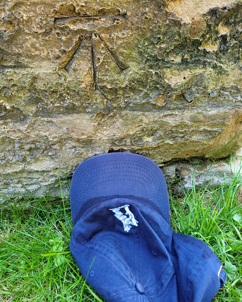
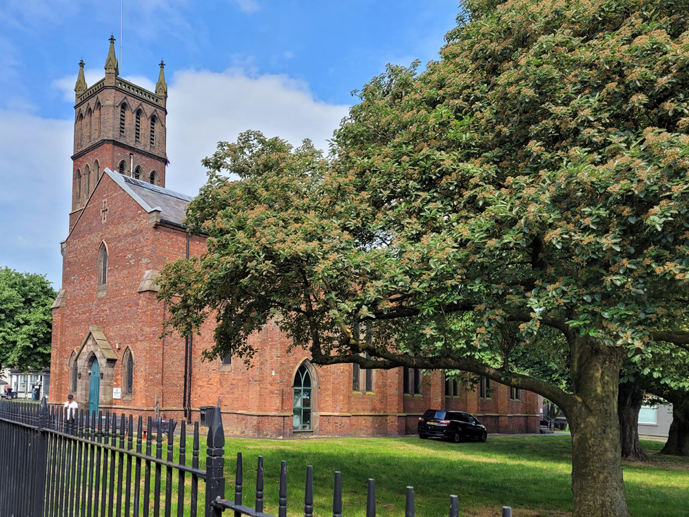
Christ Church contained the other two. While reading the database to see where to find the Flush Bracket, a local asked if I needed directions. He was actually familiar with the OS features of the building when I started explaining myself. The tower is an actual Triangulation Point (TP18164) but merely an Intersectional Station.
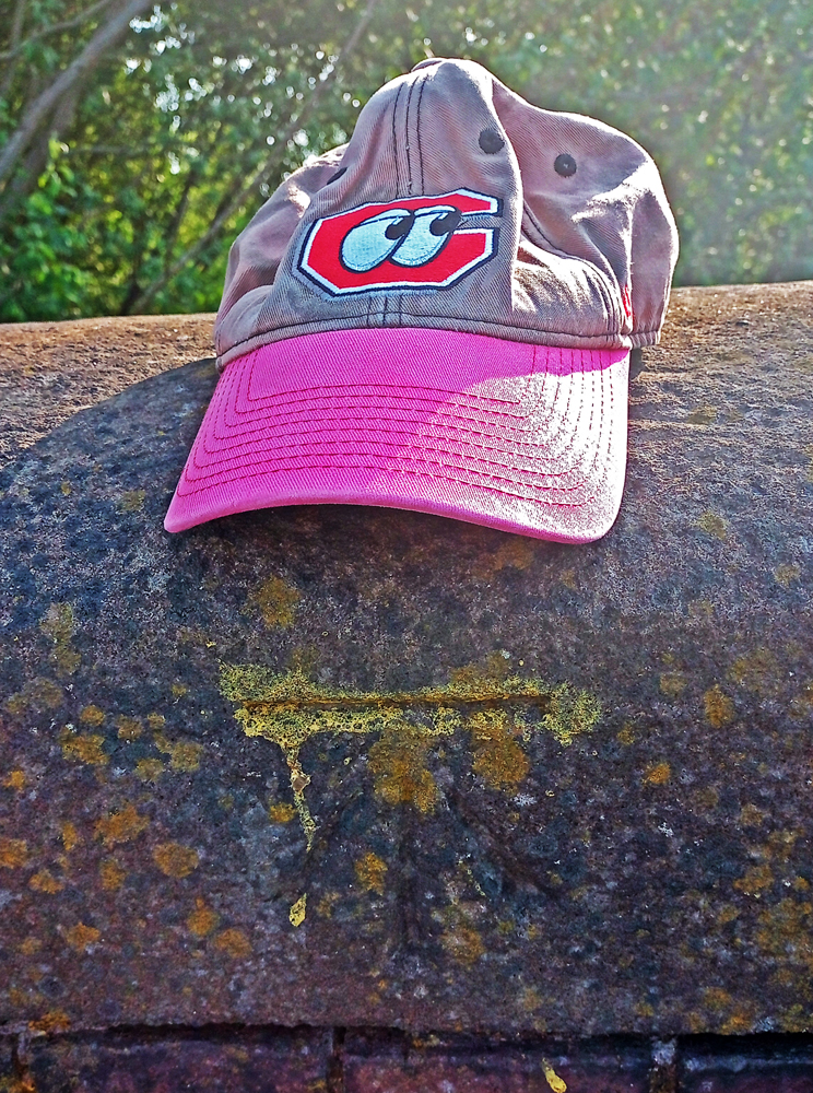
On the more eastern face of the church, FB #S1388 sits partially buried by paving bricks. When it was last levelled, it was 1 foot above ground level (0.3m AGL). The important bits are still there, though.
There’s also a Cut Mark at the base of the tower but I’ll save that for another trip.
One of the joys of TrigPointing, so far, has been the historical aspect. The databases I use have been transcribed and largely not updated since the Triangulation Point, Flush Bracket, or Cut Mark were originally entered.
The church behind the clock tower is gone and another is obscured by the YMCA tower next to the old cinema site
The Tower Cinema was opened in 1935 (first film was The 39 Steps) at a location that is now a car park near the Carters’ Green Clock Tower. There was a pin — essentially a rivet that served as a reference point for the Ordnance Survey — that came down with the building in the mid-1990s after a name change to ABC Cinema (in 1961) and a function change to bingo hall in 1969 (last film was Hot Millions).
I’m certain the Black Cock pubs I’ve been in were so-called for different reasons
The humorously named Black Cock public house sat just around the corner on Guns Lane but closed for business in 2002 after nearly 150 years. Its first publican raised fighting fowl and had a breed of black cock that the pub was named for. It is now a semidetached house. Someone plastered/screeded over the cut mark in the meantime (should be about a foot above the pavement facing the street near the fence).
The former Hop and Barleycorn pub on Dartmouth Street is a very short walk away, but the cut mark on it was destroyed with the house. It had become a drug squat in the 90s and was finally razed in 2005 ostensibly to make a family home but almost immediately became the Masjid that is there today.
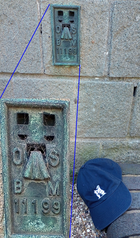
I wasn’t hungry so I spent my lunch break chasing benchmarks on campus, finding a number of cuts and my first Flush Bracket (FB, the metal plates constructed so the theodolite can mount there). The function of the FB is to give an accurate height for levelling and these are scattered about the country with most of the cut marks in the vicinity referenced to the nearest FB. Good stuff.
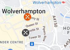
In Wolverhampton after work, I walked past a cut mark and checked the database for info only to find there to be a Triangulation Point around the next corner. Unfortunately, the church spire was torn down with the rest of the church sometime in the last few decades.
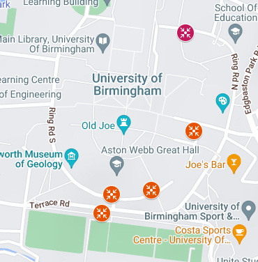
Here are the maps of these two trips. They are linked to the master map which also has photos under the markers.
I’ve just discovered another version of trainspotting (I refer you to my obsession with post boxes in reference). This one is about Ordance Survey levelling and triangulation marks. I see this as a source of entertainment that can last the rest of my life, so you have been warned that there are better ways to spend your time.
So, I have a database of Triangulation Points (TrigPoints) which, as is one of the vagaries of this obsession, can be Intersectional — and therefore may not include a brass or similar marker — or can entail a poured concrete pillar or a rivet or a wee plaque or some combination. Simpler items in my database, which ceased to be used even by the OS some decades back, include cut bench marks meant for surveyors to have some standard elevation to refer to. it is a fantastic system.
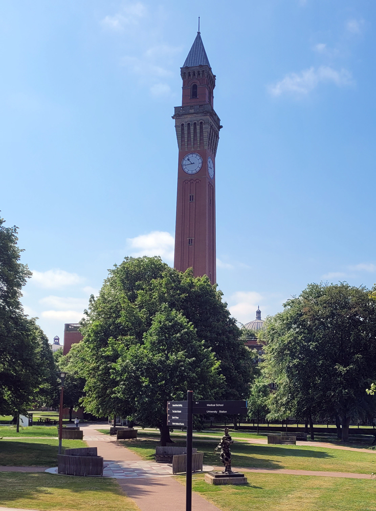
This episode includes the Old Joe tower most of my readers will know from Lord of the Rings which is also a registered TrigPoint; and, a cut benchmark (Cut Mark or CM, for short) on a building downtown that sits across from Constitutional Hill from the Hen and Chickens.